
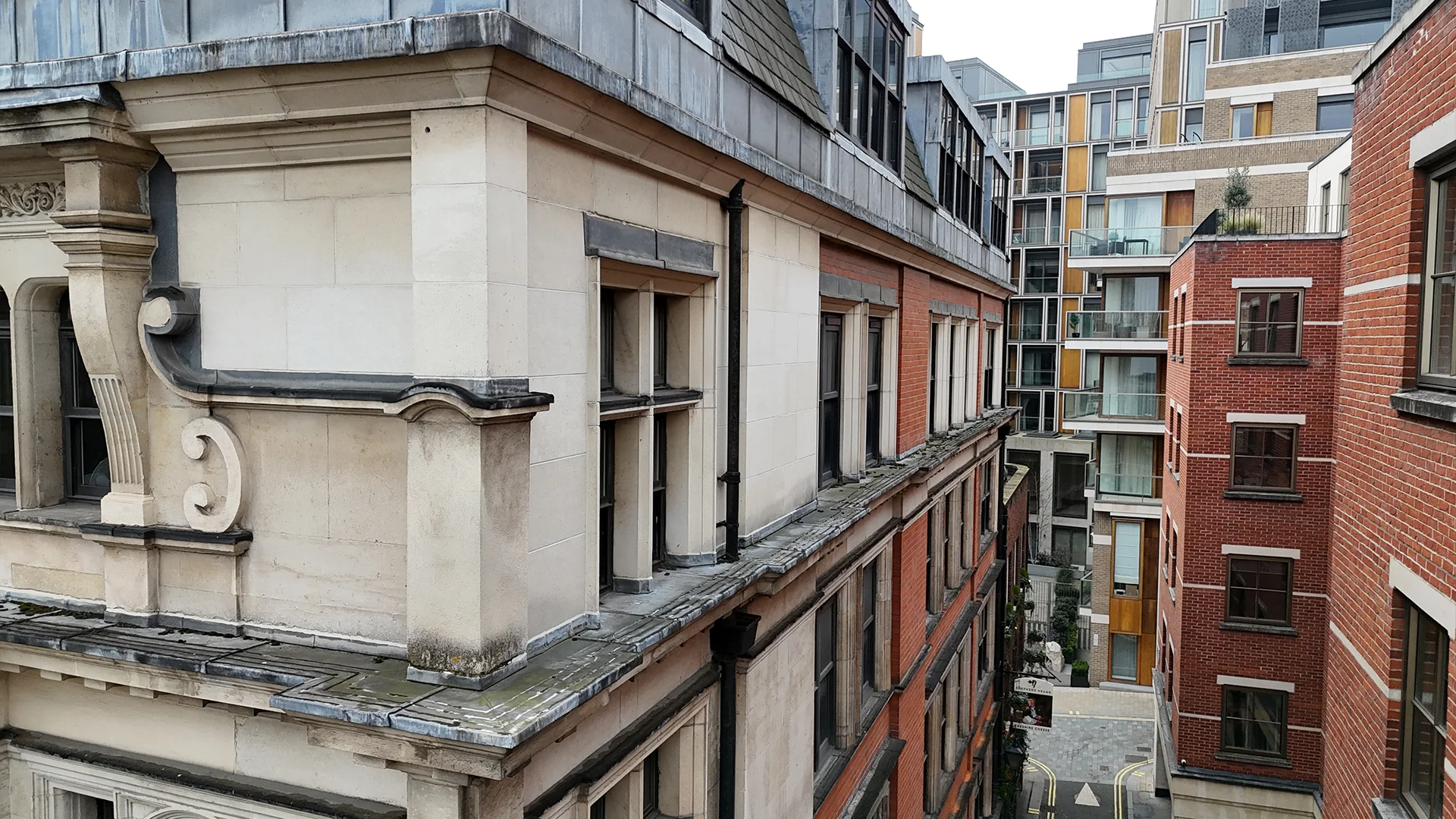
Façade & Building Inspections
Drone Property Inspections
Rapid 4K drone inspections of façades, brickwork, windows, balconies and high-level features, spotting cracking, pointing failures, failing render and water ingress early, with no scaffolding, no access towers and no working at height.
DRONE PROPERTY INSPECTIONS, EXPLAINED
A drone property inspection uses a high-resolution camera to examine the exterior of a whole building from the air: façades and elevations, brickwork and pointing, render, windows and sills, balconies, parapets, chimneys and other high-level features. Instead of scaffolding, access towers or cherry pickers, the drone gets close to every elevation safely, capturing crisp 4K imagery that reveals cracking, spalling, failed pointing and signs of water ingress long before they become expensive repairs.
It is a quick, low-cost way for homeowners, landlords, managing agents, surveyors and insurers to understand the overall condition of a residential or commercial building, whether for pre-purchase due diligence, planned maintenance or insurance purposes. Every inspection is flown by a CAA-registered pilot, with imagery often delivered the same day. If your main concern is the roof covering itself, see our specialist drone roof inspections.
WHERE DRONE INSPECTIONS MAKE THE DIFFERENCE
Whole-building condition
See every elevation in a single survey, from ground level to chimney stacks and parapets, to build a complete picture of a building's condition.
No working at height
Inspect tall or awkward elevations without scaffolding, access towers or cherry pickers, removing both the risk and the cost of access.
Pre-purchase due diligence
Understand the true condition of a building's exterior before you commit, giving buyers and their surveyors confidence in the purchase.
Insurance claim evidence
Document water damage, cracking and façade defects with clear, high-resolution imagery to support insurance claims.
Planned maintenance programmes
Build a photographic record of a building over time, so repairs can be planned, budgets prioritised and defects tracked between inspections.
Same-day imagery
Get high-resolution imagery quickly, often on the day of the flight, with full reports typically within 3 to 5 business days.
HOW A DRONE PROPERTY INSPECTION WORKS
-
01
Booking and planning
Tell us about the property and what you need to know. We provide a quote, plan the flight and check airspace so the inspection is safe and compliant.
-
02
Close-up aerial capture
Our pilots fly close to every elevation, window line, balcony, parapet and chimney, capturing high-resolution 4K imagery of the whole building envelope.
-
03
Defect identification
We review the imagery to identify visible defects, from cracking and failing pointing to damaged render, deteriorating sealants and signs of water ingress.
-
04
Annotated findings
Issues are marked up on the images and located on the building, so they are easy to understand and act on.
-
05
Report and next steps
You receive a clear report with annotated images and recommended next steps, tailored for owners, agents, surveyors or insurers.
DRONE PROPERTY INSPECTIONS IN ACTION
A drone inspection puts a clear, close-up view of the whole building in your hands in a fraction of the time of a traditional access survey. Pair it with thermal imaging to find hidden damp and heat loss, or a 3D photogrammetry model when you need measurements.
DRONE PROPERTY INSPECTION FAQs
What can a drone property inspection find?
A drone can identify cracking, failed or eroded pointing, spalling brickwork, damaged or blown render, deteriorating sealants, blocked gutters and downpipes, damaged chimneys and visible signs of water ingress, spotting issues long before they show up as damp patches inside the building.
Do I need scaffolding or access equipment?
No. The drone inspects the building from the air, so there is no scaffolding, no access towers, no cherry pickers and no working at height. This makes inspections faster, safer and lower cost.
Is a drone inspection suitable for pre-purchase surveys?
Yes. It is a quick way to check the exterior condition of a building before you buy, and our imagery can support building surveyors carrying out condition reports, defect inspections and buyer's survey reports.
Can drone imagery support an insurance claim?
Yes. Clear, high-resolution imagery documents damage and defects across every elevation, providing useful evidence for a claim. Formats can be tailored for insurers, surveyors or maintenance teams.
How quickly will I get my imagery?
We are usually able to start within a day or so and can often provide imagery on the day of the flight. Data processing typically takes 24 to 48 hours, with full reports delivered within 3 to 5 business days.
Which areas do you cover?
We carry out drone property inspections across London and UK-wide. Get in touch with your location and we will confirm availability.
Book a drone property inspection
Get a fast, close-up inspection of your building's façades and elevations, captured safely from the air by our expert drone pilots
Explore more: Roof Inspections / Thermal Imaging / 3D Photogrammetry / 360° Building Scans / Dilapidations Surveys