CONTACT US

See your home from the one angle you never can

A drone survey shows every slope, chimney and gutter of your home in high-resolution detail, with no ladders, no scaffolding and no one climbing up. Use it to plan maintenance, check a roofer's quote, support a sale or find out where your heat is going.

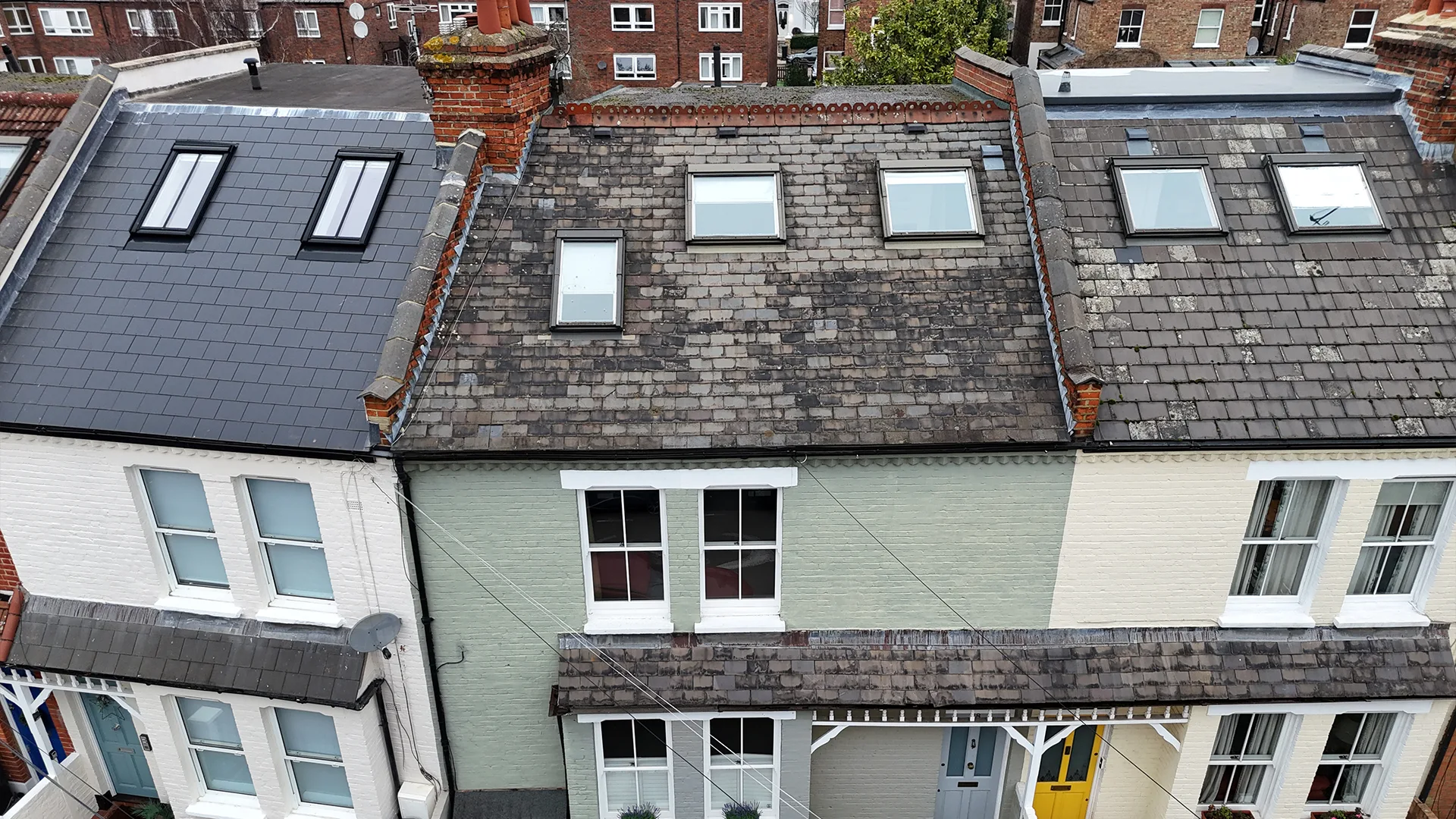
Elevated aerial drone inspection view of terraced house roofs fitted with skylights, showing contrasting newly tiled and weathered slate conditions.
20 min Quickest house survey
Same day Images often supplied
0 Ladders or scaffolding

The same pilots and cameras we use on commercial work

HeliDrone Surveys was established in 2013 and works with surveyors, property managers and owners across London and the UK. Homeowners get the same pilots, equipment and reporting standards as our commercial clients.

We survey and report. We do not carry out repairs, so the findings are not tied to a sale and you are free to take them to any roofer or contractor you choose.

01 - ROOF AND GUTTER HEALTH

Catch A slipped TILE before it becomes a ceiling stain

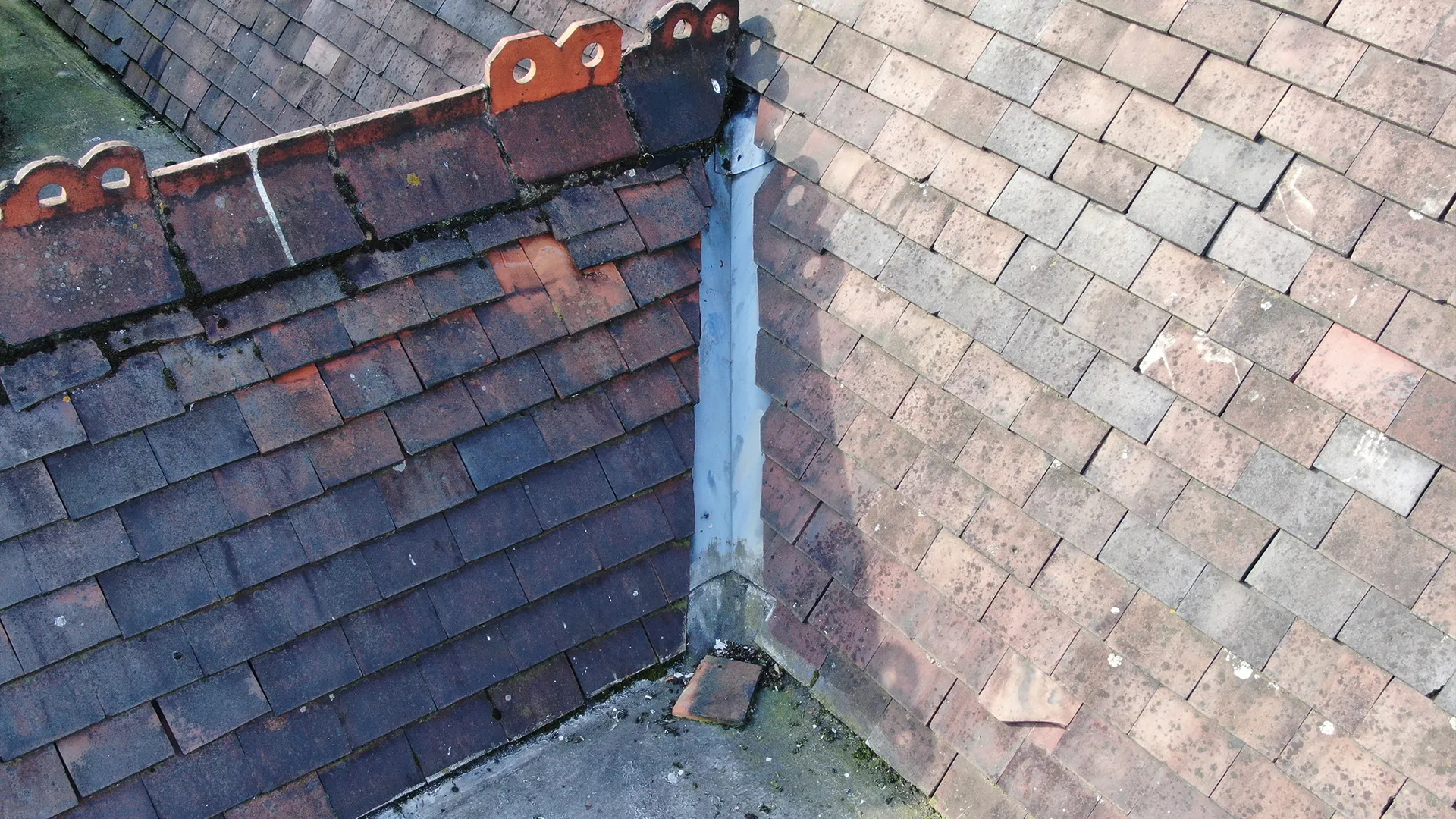
Roofs tend to fail slowly, then suddenly. A flight once a year, or after a storm, shows displaced tiles, blocked gutters, lifted flashing and worn chimney pointing whilst it is still cheap to fix. It also lets you check a roofer's quote against the evidence.

Useful when
  • After a storm or heavy winter

  • A roofer says it needs a full re-roof

  • Damp patches appearing upstairs

You receive

  • High-resolution images of every angle

  • Annotated images of any defects found

  • Video you can share with roofers

Close-up aerial drone roof inspection view showing slipped and broken tiles along a metal valley gutter. Roof inspection
02 - THERMAL IMAGING

See where your ENERGY BILLS ARE GOING

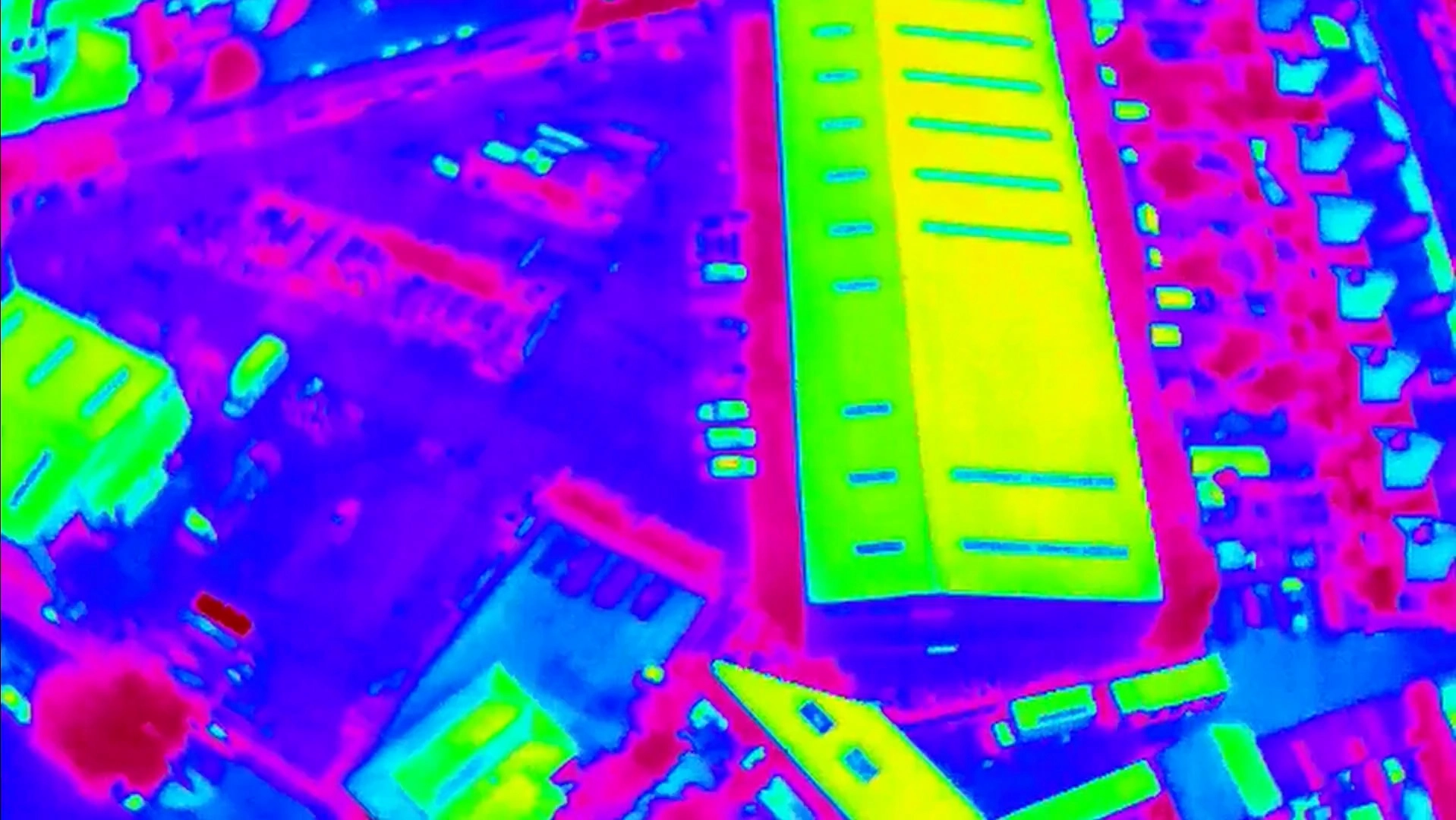
A thermal camera flown early in the morning or after dark, with your heating on, shows heat escaping through the roof, walls and windows as a colour map. It can point to missing loft insulation, cold spots and failing glazing, so you insulate what needs it rather than everything.

Useful when

  • Bills are rising despite insulation

  • You are planning a retrofit or heat pump

  • One room is always colder

You receive

  • Thermal images of each elevation

  • Matching standard images for comparison

  • Heat loss areas marked up

Aerial drone thermal imaging view of a large commercial building roof and surrounding site displayed in a high-contrast rainbow heat map palette. Radiometric thermal capture
03 - PRE-PURCHASE SUPPORT

Know what you are buying before you exchange

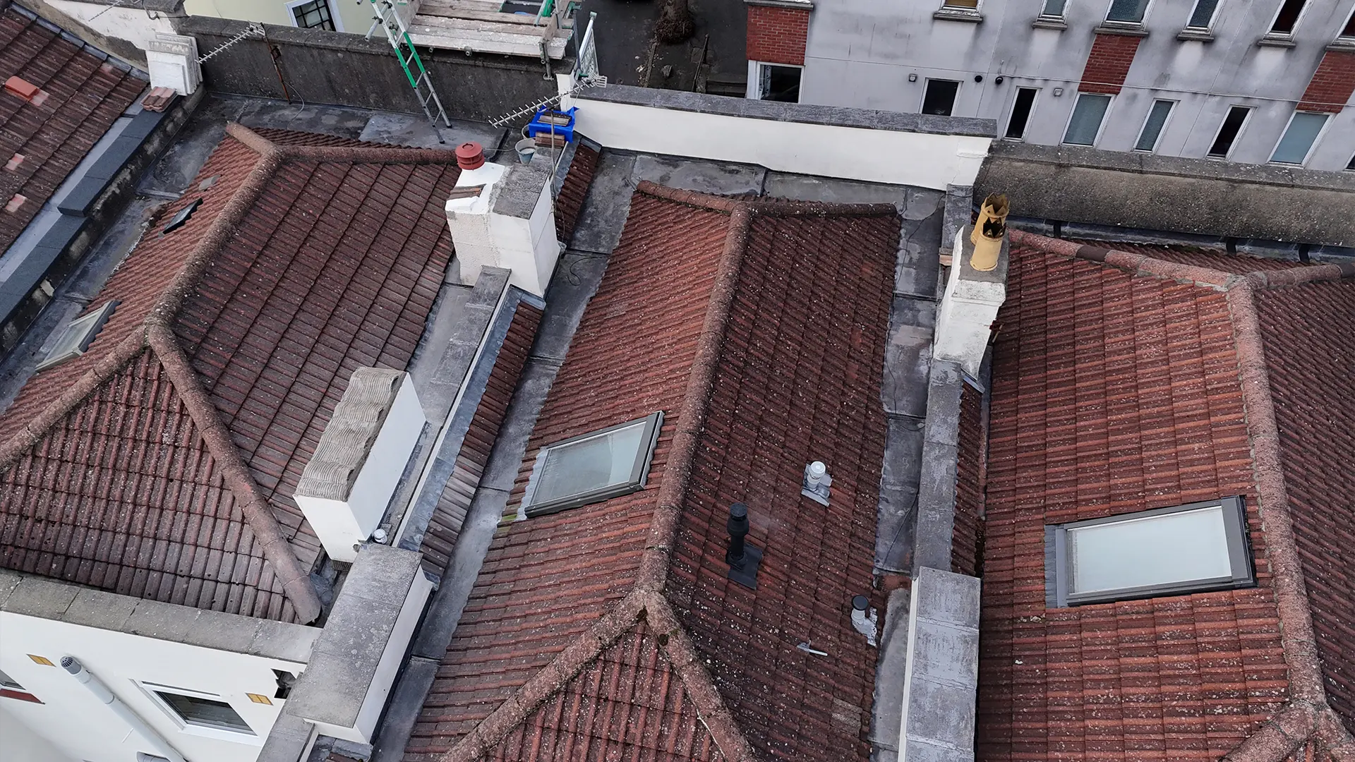
A building survey may only be able to inspect the roof from the ground. Drone imagery gives you and your surveyor a close, dated view of every slope, chimney stack and gutter run, so problems found before exchange can be part of the price conversation.

Useful when

  • Your survey says the roof was not fully visible

  • It is an older or listed property

  • You are negotiating after an offer is accepted

You receive

  • Dated, located roof imagery

  • Images your surveyor can refer to

  • A quick turnaround to fit your timeline

High-angle aerial drone roof inspection view showing multi-pitched red tile rooftops with chimney stacks, skylights, and lead valley gutters. Pre-purchase survey
04 - AERIAL IMAGERY

Show your home and its plot properly

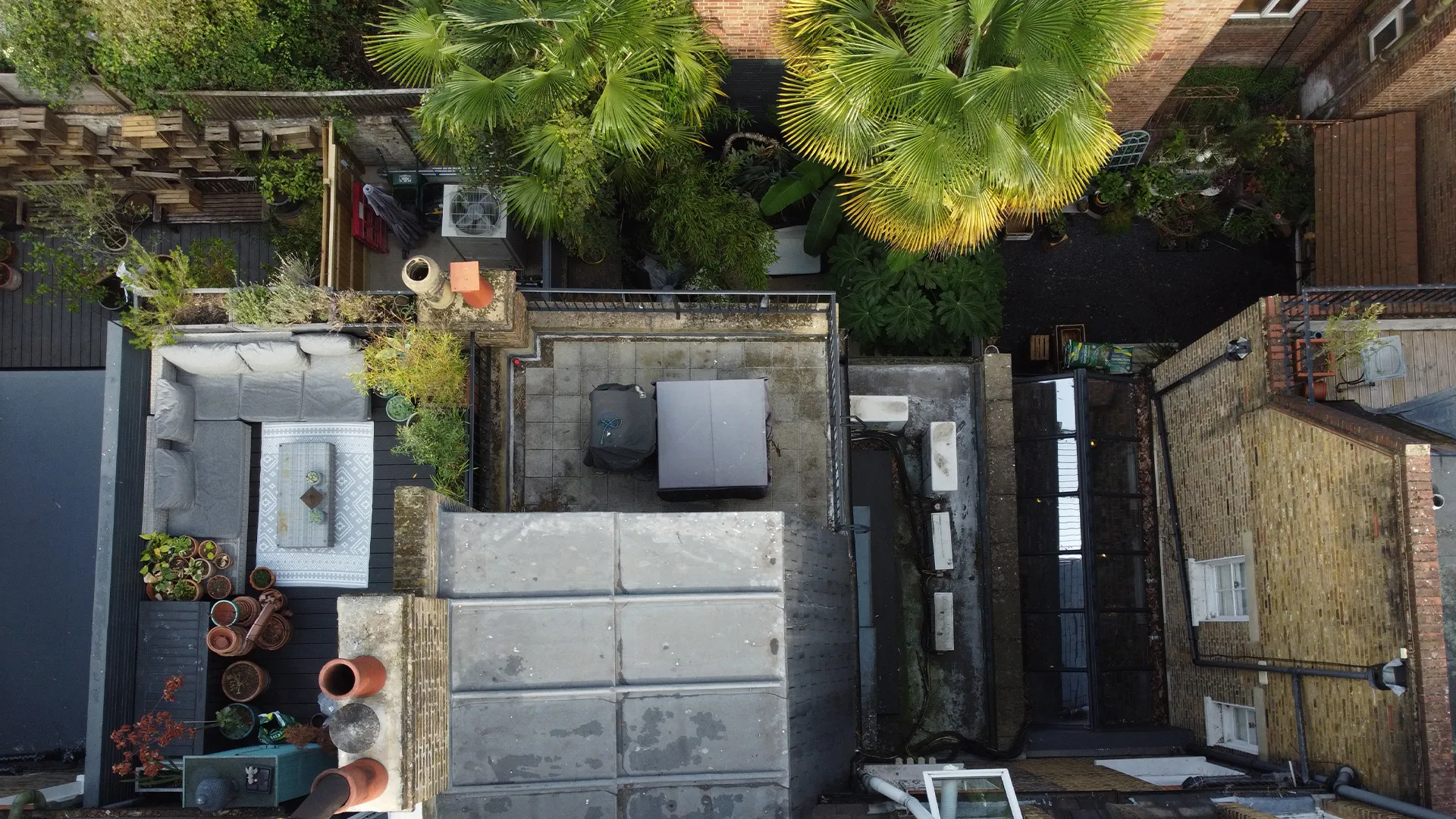
Aerial images show buyers what floor plans cannot: garden size, orientation, parking and surroundings. Add a roof survey and you answer a buyer's biggest question before they ask it.

Useful when

  • You are listing your home for sale

  • You are preparing a valuation or remortgage

  • You have a large garden or unusual plot

You receive

  • Aerial stills of the property and plot

  • A short video flyover

  • Roof images to share with buyers

Overhead aerial drone inspection view of a residential building featuring a furnished rooftop terrace, chimney stacks, and a lush garden courtyard. Aerial imagery
05 - STORM AND DAMAGE EVIDENCE

Dated evidence for your insurer

After a storm, a fallen tree or a leak, your insurer will want evidence. We capture dated, close-up imagery of the damage and how far it extends, so your claim is backed by more than a description.

Useful when

  • Tiles or the ridge are storm damaged

  • Water is coming through a ceiling

  • A neighbour's works have caused damage

You receive

  • Dated images of the damage

  • The extent of the damage across the roof

  • Files you can send straight to your insurer

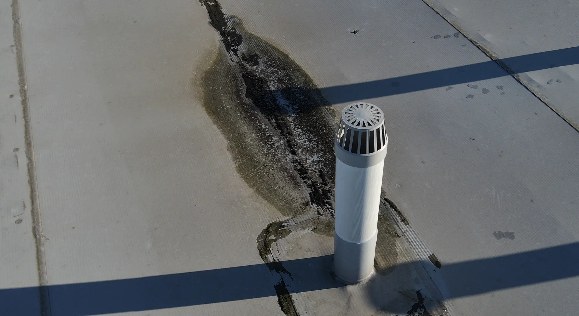
Water staining on a flat roof surface extending from the base of a white vent pipe Damage evidence
06 - PLANNING AND PROJECTS

Plan the loft, extension or solar array properly

Architects and installers need accurate information about your roof. We can supply close imagery and measured data to help plan a loft conversion, an extension or solar panels, and check existing panels for faults.

Useful when

  • You are considering a loft conversion

  • You are getting solar PV quotes

  • Existing panels are underperforming

You receive

  • Detailed images of the roof and surroundings

  • A measured 3D model or map where needed

  • A thermal check of existing solar panels

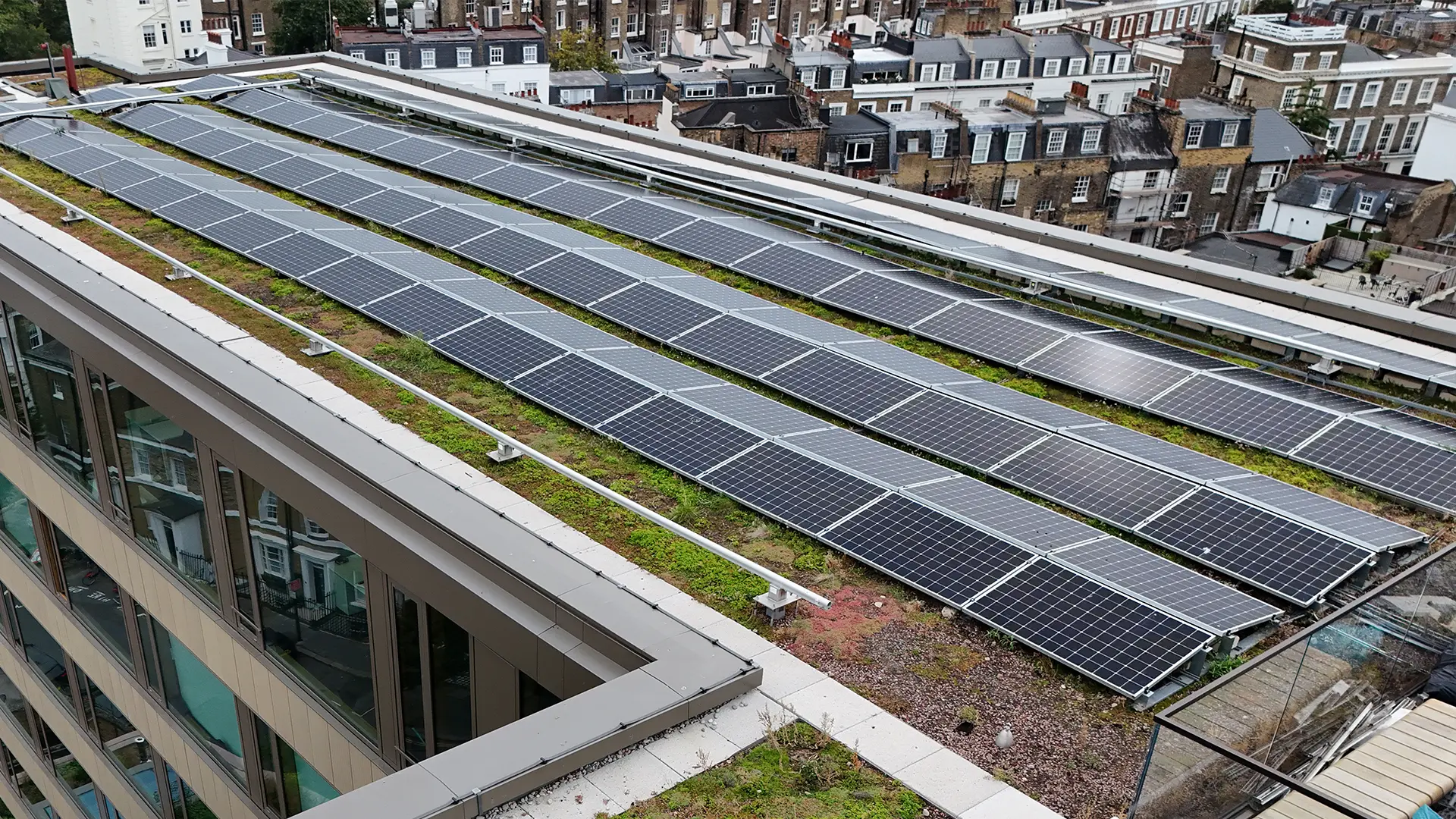
High-angle aerial drone view of long solar panel arrays installed on a vegetated green rooftop. Solar and planning

Less disruption than a window cleaner

01

Tell us what you need

Send your postcode and what you would like to know. We check the airspace and send you a quote before anything is booked.

02

We book a date

We can usually start within a day or so, unless special permissions are needed. If the weather is poor, we rebook at no charge.

03

The flight

A straightforward house can take as little as 20 minutes on site. Nobody goes on your roof, and you do not need to be at home, although you are welcome to watch.

04

Your images and report

Images are often supplied on the same day. A written report follows within 3 to 5 business days, and we are happy to talk you through the findings.

Know the cost before we fly

Basic surveys start from £295. The final price depends on the size and type of property, whether you want thermal imaging, and how quickly you need the results. We quote before anything is booked.

Maintenance, buying, insurance

Roof inspection

From £295
  • Images of every roof slope

  • Annotated images of defects

  • Video flyover

With thermal imaging

Roof and thermal

Quoted
  • Everything in a roof inspection

  • Thermal images of all elevations

Selling and valuation

Aerial imagery

Quoted
  • Aerial stills of property and plot

  • Short video flyover

  • Optional roof images for buyers

What homeowners say

“Thanks to HeliDrone we booked a fantastic roof inspection service for our roof problems, same day service, we got excellent photos and videos we can now show to our prospective roofers for a quote.”
Matt Google review
“Bob was extremely helpful and easy to communicate with, and he was able to carry out the inspection at short notice. He provided all images on the same day, which was much appreciated.”
SusanG Google review, South London
“The survey showed us exactly where and what our roof issues are and it has been invaluable to see for ourselves.”
Andrew and Teresa Google review, Hilly Fields SE4

Before you book

Something not covered here? Call 0800 038 5795 or 07890 759505, Monday to Friday, 08:00 to 18:00, or email info@helidronesurveys.co.uk.

Basic surveys start from £295. The price depends on the size and type of property, whether you want thermal imaging as well, and how quickly you need the results. Send us your address and we will give you a quote before anything is booked.

No, it supports one. A surveyor may only be able to see a roof from the ground or from a ladder. Our images give them, or you, a close, dated view of every slope, chimney and gutter, so the assessment is based on what is actually there.

No. As long as we have access and have agreed the details in advance, we can carry out the survey without you. You are welcome to be there if you would like to watch or talk to the pilot about particular areas.

In most cases a drone can briefly fly over neighbouring land as part of a survey, but we keep this to a minimum and stay within your boundary wherever possible. If a survey needs sustained flight over a neighbouring property, we will tell you in advance so permission can be sought if needed.

Every image is dated and taken close to the area in question, which is the kind of evidence insurers usually ask for. Whether a claim is accepted is up to your insurer, so we suggest checking what they need before we fly.

In the cooler months, in dry conditions, usually early in the morning or after dark with the heating on. We will advise on timing when you book.

We cannot fly safely in strong winds (typically above 25mph), rain or snow. If conditions are poor, the flight is postponed at no charge and rescheduled for the next suitable day.

Yes. Our pilots are CAA-registered and we hold Operational Authorisation for our type of operations. We carry £5m public liability cover plus professional indemnity insurance.

Yes. We are happy to share example reports from previous projects, with client details removed, so you can see the format and level of detail first.

Find out what is on your roof

Send us your postcode and what you would like to know. We will reply with a quote and the earliest date we can fly.