
CONTACT US

Drone Surveys in London

CAA-registered drone surveys across Greater London: roof and façade inspections, thermal imaging, 3D photogrammetry and dilapidations, with no scaffolding, no cherry pickers and London's airspace permissions handled for you.

Drone surveys in London, explained

A drone survey uses a high-resolution or thermal camera to capture roofs, façades and whole sites from the air. In London, where buildings are tall, terraced and tightly packed, it replaces scaffolding, cherry pickers and rope access with a flight that takes as little as 20 minutes for a house and a few hours for a large building.

HeliDrone Surveys has flown London since 2013 from our base in Lewisham, SE4. We work for building surveyors, property managers, religious and educational institutions, and homeowners. Because much of the capital sits under controlled airspace, every flight is planned, permitted where needed and risk-assessed before we arrive. New to the idea? Read how drone surveys compare with traditional survey methods.

Drone survey services across London

PROPERTY & ROOF INSPECTIONS

Close-up 4K imagery of roofs, chimneys, gutters and elevations, from Victorian terraces to tower blocks, without scaffolding or access equipment.

LEARN MORE

THERMAL IMAGING

Radiometric heat-loss and damp surveys for retrofit planning, flat-roof leak detection and solar PV fault-finding.

LEARN MORE

3D PHOTOGRAMMETRY

Measured 3D models and orthomosaics for architects, planners and surveyors working on London sites.

LEARN MORE

DILAPIDATIONS SURVEYS

Dated, located condition records at lease start and end: clear evidence for landlords and tenants.

LEARN MORE

360° BUILDING SCANS

Immersive aerial panoramas for site progress, marketing and remote stakeholder review.

LEARN MORE

SURVEYS FOR HOMEOWNERS

Roof checks, heat-loss maps and pre-purchase imagery, sized and priced for a single home.

LEARN MORE

Flying in London's restricted airspace

Airport flight restriction zones and central London's restricted areas affect a large number of London sites. We plan for them as standard and include the permissions work in your fixed quote.

Read how we flew a survey close to London City Airport

Unrestricted areas Much of outer London. Standard flight planning and risk assessment.
Airport flight restriction zones Around London City, Heathrow, Northolt and Biggin Hill. Permission applied for through the CAA and NATS non-standard flight process.
Central London restricted areas Westminster, the City and the Thames corridor. Site-specific approval is required, and parts of the river sit on London's helicopter routes.
Royal Parks & landmarks Landowner consent on top of airspace approval. We manage the full application.

Drone survey coverage across all London boroughs

Based in Lewisham, SE4, we are well placed for South and East London, and we travel across the whole of Greater London. Outside the capital we also cover Kent, Surrey, Essex, Hertfordshire and the wider UK.

Central London

  • City of London

  • Westminster

  • Camden

  • Islington

  • Kensington & Chelsea

North London

  • Barnet

  • Enfield

  • Haringey

  • Harrow

  • Brent

East London

  • Tower Hamlets

  • Hackney

  • Newham

  • Waltham Forest

  • Redbridge

  • Barking & Dagenham

  • Havering

South London

  • Lewisham

  • Southwark

  • Lambeth

  • Greenwich

  • Bexley

  • Bromley

  • Croydon

  • Sutton

  • Merton

  • Wandsworth

  • Kingston upon Thames

West London

  • Hammersmith & Fulham

  • Ealing

  • Hounslow

  • Hillingdon

  • Richmond upon Thames

How a London drone survey works

  1. 01

    Postcode check

    Send us the address and a brief. We check the airspace category and confirm what permissions the site needs.

  2. 02

    Permissions and fixed quote

    You receive a fixed quote with permissions included. Where needed we apply through the CAA and NATS non-standard flight process and arrange landowner consent.

  3. 03

    Site risk assessment

    We plan the launch point, neighbouring properties, traffic and public access, and notify residents where appropriate.

  4. 04

    Flight and capture

    From around 20 minutes for a house to a few hours for a large building. Visual, thermal or mapping capture, depending on the survey.

  5. 05

    Data and report

    Imagery is often supplied the same day. A written, annotated report follows within 3 to 5 working days.

Recent London drone survey case studies

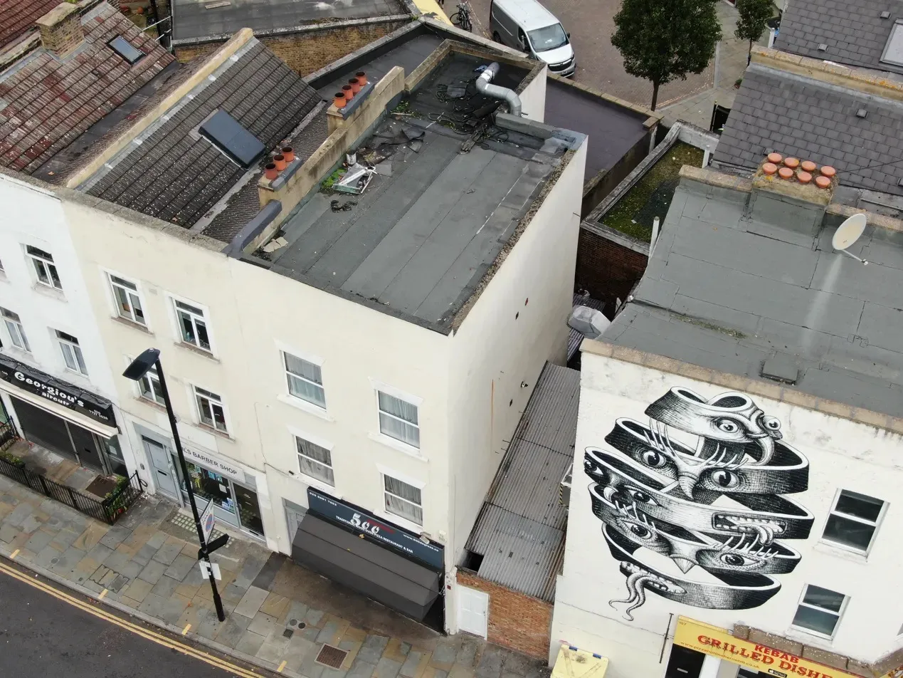
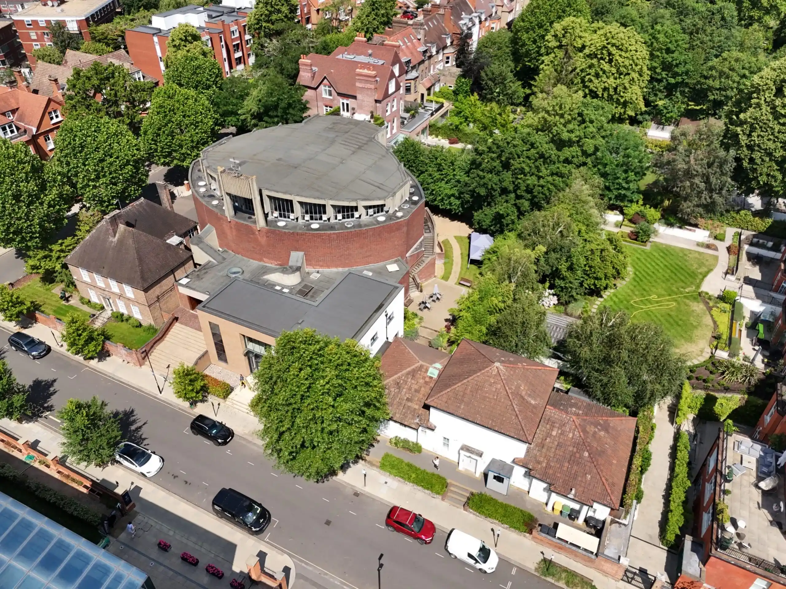
Herne Hill, SE24 · Property inspection

Roof survey of a mixed-use building in Herne Hill

A property management company needed a condition assessment of interconnected commercial and residential buildings. The drone survey took under four hours, against an estimated two to three days with scaffolding, with imagery delivered the same day.

Read the case study →
Tower Bridge · Property inspection

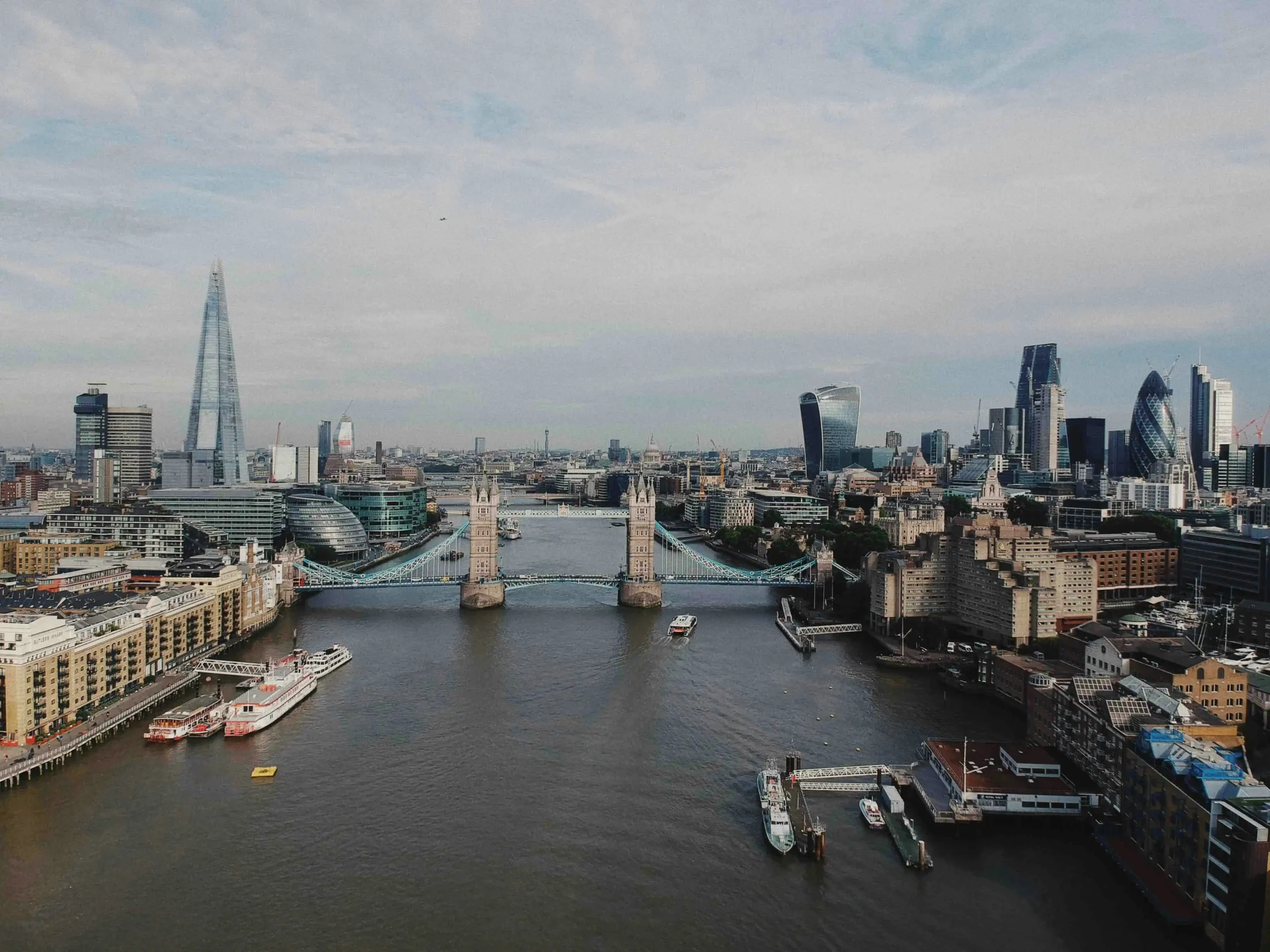
Riverside property survey beside Tower Bridge

Roof and elevation imagery of a Thames-side property for the building surveyor of a prospective buyer, flown right on the edge of restricted airspace and a London helicopter route.

Read the case study →

What London clients say

“Thanks to HeliDrone we booked a fantastic roof inspection service for our roof problems, same day service, we got excellent photos and videos we can now show to our prospective roofers for a quote.”
Matt Google review
“Bob was extremely helpful and easy to communicate with, and he was able to carry out the inspection at short notice. He provided all images on the same day, which was much appreciated.”
SusanG Google review, South London
“The survey showed us exactly where and what our roof issues are and it has been invaluable to see for ourselves.”
Andrew and Teresa Google review, Hilly Fields SE4

Drone survey London FAQs

Something not covered here? Call 0800 038 5795 or 07890 759505, Monday to Friday, 08:00 to 18:00, or email info@helidronesurveys.co.uk.

Yes, with the right permissions. Parts of central London, and the areas around London City, Heathrow, Northolt and Biggin Hill, sit inside restricted airspace or flight restriction zones. Our pilots are CAA-registered and we hold an Operational Authorisation. Where a site needs extra permission, we apply on your behalf through the CAA and NATS non-standard flight process before we fly.

Basic house surveys start from £295. Commercial buildings, thermal and 3D surveys are quoted on scope, including site size, access, the deliverables you need and how quickly you need them. Every quote is fixed and includes any airspace permissions work, so there are no surprises.

Unrestricted sites can usually be flown within two to three working days. Sites that need restricted-airspace permission typically take five to ten working days, as the approval process sets the timeline.

Yes. We cover all 32 London boroughs and the City of London, plus Kent, Surrey, Essex, Hertfordshire and the wider UK.

Rarely. Most flights launch from the client's own land. Where we need to launch from public space, we arrange landowner or council permission as part of the planning.

Yes. We carry public liability and professional indemnity insurance and run a site-specific risk assessment for every flight, including occupied and tenanted buildings. We are happy to send a copy of our insurance certificate on request.

No, it supports one. A surveyor may only be able to see a roof from the ground or from a ladder. Our images give them, or you, a close, dated view of every slope, chimney and gutter, so the assessment is based on what is actually there.

We cannot fly safely in strong winds (typically above 25mph), rain or snow. If conditions are poor, the flight is postponed at no charge and rescheduled for the next suitable day.

Book a drone survey in London

Send us the postcode and what you need. We check the airspace and send you a fixed quote and a flight date before anything is booked.